
Land Surveyor – N4ce Data Processor
Job Description
Permanent
Location – Derby – Hybrid
Salary Negotiable Depending on Experience
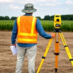
A fantastic opportunity has arisen for an experienced Land Surveyor – N4ce Data Processor to join a well-established geospatial surveying company operating across the UK with ISO 9001, Constructionline Gold, CHAS, RISQS, and TSA accreditation. The company specialises in topographical and engineering surveys, underground utilities surveys, measured building surveys, 3D reality capture, UAV drone surveys, and monitoring and remote sensing, delivering projects across railways, highways, heritage, construction, mineral extraction, and public sector developments throughout the UK. With a strong emphasis on accuracy, collaborative working, and cutting-edge laser scanning and drone technology, this is a company where a Land Surveyor – N4ce Data Processor can genuinely thrive, develop, and make their mark.
This hybrid position will involve the Land Surveyor – N4ce Data Processor working closely with field surveyors and project managers to process and deliver high-quality topographical survey data. The successful Land Surveyor – N4ce Data Processor will produce AutoCAD drawings and manage survey deliverables using N4ce software from the Derby office and remotely.
Responsibility & Duties
- Process field survey data using N4ce software to industry standards
- Produce accurate topographical survey drawings and plans in AutoCAD format
- Quality check survey data and deliverables for accuracy and completeness
- Collaborate with field surveyors on project requirements and technical specifications
- Manage survey control networks and coordinate transformation for project alignment
- Deliver final survey outputs, including DTMs, contours, and feature drawings
- Support UAV drone survey data processing and point cloud management
- Ensure all deliverables meet client specifications and project deadlines
Experience & Qualification
- 3+ years’ experience in land surveying or topographical survey data processing
- Advanced proficiency in N4ce software for survey data processing essential
- Strong AutoCAD skills for the production of topographical survey drawings are required
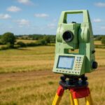
- Experience with total stations, GPS, and modern surveying equipment is desirable
- Understanding of survey control, coordinate systems, and transformation processes essential
- Point cloud processing experience using software such as Cyclone is advantageous
- Excellent attention to detail and commitment to delivering accurate outputs
- Full UK driving licence and ability to work independently essential
If you are an experienced Land Surveyor – N4ce Data Processor and this role is of interest, please send your most up-to-date CV to the details below and get in touch straight away.
pritesh@t-talent.co.uk
0739 343 5248
Linkedin- priteshtailorcad